Subsurface Structure Investigation of the Longitudinal Valley, Eastern Taiwan from High-Resolution Seismic Reflection Data
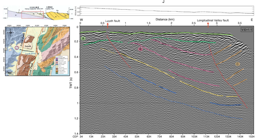
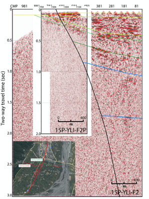
The profile J north of the Peinanshan in Luyeh reveals the east-dipping Luyeh fault, and the undulations of the alluvium strata are observed as a result of the fault.
The deformation and tilting of the sedimentary strata in the southern Longitudinal Valley is inferred to relate to the collision toward the northwest from the southern Costal Range and the reverse movement of active faults in the LV.
賴思穎 Szu-Ying Lai 碩士論文:應用高解析反射震測探討花東縱谷地下構造 Master’s Thesis: Subsurface Structure Investigation of the Longitudinal Valley, Eastern Taiwan from High-Resolution Seismic Reflection Data
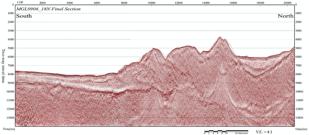
Seismic reflection survey in the northern part of the Longitudinal Valley, the suture zone, in eastern Taiwan
In this study, we found that beneath the longitudinal valley, there are about 2000 m thick of sedimentary beddings laid on top of the basement dipping to the east.
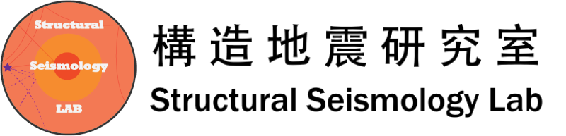
In fact that only Lingding fault has been found in the section, no other major fault has been discovered.
謝一銘 Yi-Ming Shie 碩士論文:台灣花東縱谷北段反射震測調查 Master’s Thesis: Seismic reflection survey in the northern part of the Longitudinal Valley, the suture zone, in eastern Taiwan
We have completed four seismic profiles with a total of 10.748 km in length and according to the seismic data four unconformities can be identified from seismic stratigraphy analysis.
According to the analysis of sequence stratigraphy, it is found that this area is in a sedimentary cycle from the development of the transgressive system to the high stand system tracts, and from the topographies of the unconformities in different periods it indicates that the river was through headward erosion.
呂奇祝 Ci-Jhu Lyu 碩士論文:利用複反射衰減方法提高海上震測成像並探討南琉球隱沒系統 Master’s Thesis: Improving the seismic imaging in the southern Ryukyu subduction system by using multiple attenuation methods